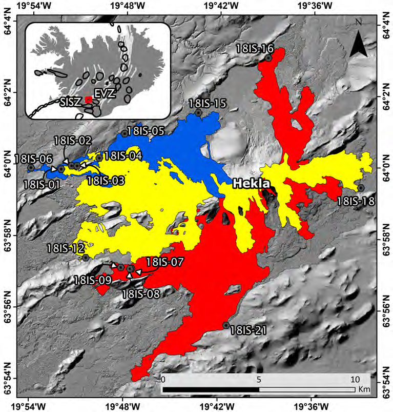
New remote sensing data, historical reports, petrology and estimates of viscosity based on geochemical data are used to illuminate the lava emplacement flow-lines and vent structure changes of the summit ridge of Hekla during the large eruptions of 1845–46 and 1766–68. Based on the planimetric method we estimate the bulk volumes of these eruptions close to 0.4 km3 and 0.7 km3, respectively. However, comparison with volume estimates from the well-recorded 1947–48 eruption, indicates that the planimetric method appears to underestimate the lava bulk volumes by 40–60%. Hence, the true bulk volumes are more likely 0.5–0.6 km3 and 1.0–1.2 km3, respectively. Estimated melt viscosity averages for the 1766–68 eruption amount to 2.5 _102 Pa s (pre-eruptive) and 2.5_103 Pa s (degassed), and for the 1845–46 eruption 2.2_102 Pa s (pre-eruptive) and 1.9_103 Pa s (degassed). Pre-eruptive magmas are about one order of magnitude more fluid than degassed magmas. In the 1845–46 and 1947–48 eruptions, SiO2 decreased from 58–57 to 55–54 wt% agreeing with a conventional model that Hekla erupts from a large, layered magma chamber with the most evolved (silicarich) magmas at the top. In contrast, the lava-flows from 1766–68 reveal a more complicated SiO2 trend. The lava fields emplaced in 1766 to the south have SiO2 values 54.9–56.5%, while the Hringlandahraun lava-flow that erupted from younger vents on the NE end of the Hekla ridge in March 1767 has higher SiO2 of 57.8%. This shows that the layered magma chamber
The 1845–46 and 1766–68 eruptions at Hekla volcano: new lava volume estimates, historical accounts and emplacement dynamics by R. Vestergaard et al.
[dssb_sharing_buttons use_sharing_title=”on” use_global_sharing=”on” _builder_version=”4.11.3″ _module_preset=”default” global_colors_info=”{}”][dssb_sharing_button button_text=”Share article” use_custom_icon_size=”on” _builder_version=”4.11.3″ _module_preset=”default” border_radii_item=”on|12px|12px|12px|12px” border_radii_icon=”on||||” global_colors_info=”{}”][/dssb_sharing_button][/dssb_sharing_buttons]

